SOUTH GEORGIA
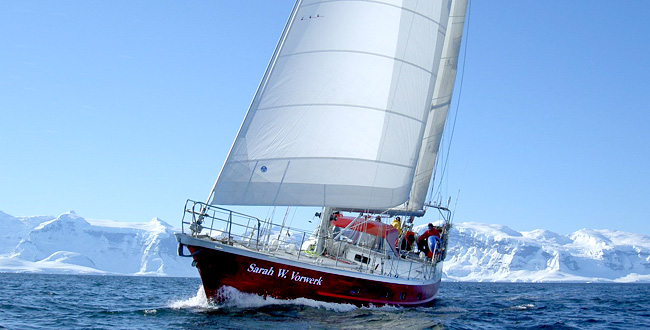
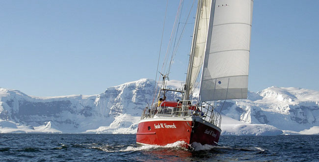
A sailingtrip to the end of the world
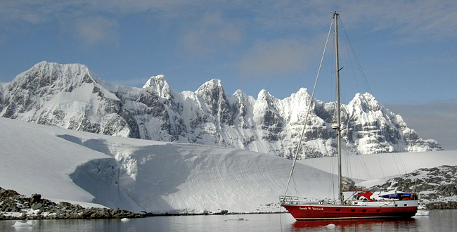
South Georgia has been described like "the Himalayas seen from Simla" as the mountains are a magnificent sight - especially in moonlight. It is the highest , most mountainous and second largest of the small number of islands, which encircle the Antarctic Continent. Two principal mountain chains effectively form the islands spine. The highest peak is Mount Paget (2.934 m), whilst twelve other peaks exceed 2000 m.
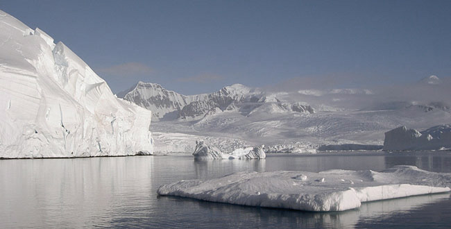
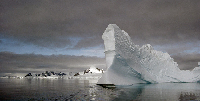
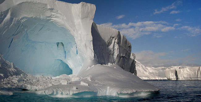
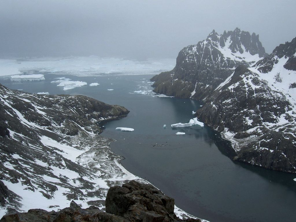
The highest peaks are concentrated around the middle section of the crescent shaped island mainly, where they provide a substantial barrier against the severe weather which reaches the south-west side of the island with the prevailing winds. The area in the lee has a comparatively less severe climate. South Georgia is 106 miles long and one to nineteen miles wide and reached from the Falkland Islands, within five to six sailing days. The coast consists mainly of high sea cliffs which are interrupted by many fjords and glaciers. The fjords provide a variety of harbours and anchorages, some deep and clear, others with sunken rocks and reefs, many of them have glaciers at their heads. Glacier snouts, which reach the ocean or waters of the bays and fjords, can be very spectacular - especially when enormous pieces break off and crash into the water (a process, termed calving). Bergy bits, growlers and brash ice infest many bays, mainly during early summer. Permanent snow begins at 200 m on the exposed south-west side and 400 m on the protected north-east side. The mountains are dissected by large numbers of deep fjords, most of which contain glaciers. Fifty percent of South Georgia is covered by glaciers. Some floating glacier fronts may be up to 50 m high, 250 m deep and over one km wide. There are over two dozen lakes on the island. Several of them have been formed, where glaciers have dammed valleys. Gulbrandsen Lake, near Husvik, is the largest and most spectacular of these with icebergs floating in it and a series of over twelve major terraces on its shores (representing previous lake levels). Ponds, pools and tarns are common throughout the island. Another distinctive ground feature is found near many flatter areas on the coast behind beaches .- Elephant seal wallows. Caused by the seals lying closely packed, in mud during their moulting periods (February, March). The wallows are often one m deep and become exceedingly foetid with skin, fur, faeces, combined with thin mud and the occasional dead seal.
There are millions of breeding seals and penguins: 3 million Macaroni Penguins, 1 million Fur Seals, 360.00 Elephant seals, 400.000 Gentoo Penguins, 300.000 King Penguins (of which 100.000 at St. Andrews Bay). Also a vast number of breeding Albatross (Wandering) is to be seen.
Until the middle of this century, South Georgia was a centre for the whaling industries. During the last century a couple of whaling stations had been established. The last one was abandoned in 1965. Grytviken was the main settlement with church and cinema. The ruins have been reoccupied by the seals. The church has been saved and restored, the cinema fell into shambles in 1996.
South Georgia is English territory and was declared a nature reserve. It is administered by the Falkland Dependency Administration and counts two research and one administrative settlement (clearance and post office).
Itinerary South Georgia
1. Day Mount Pleasant - Port Stanley
By bus or taxi from the airport to downtown Stanley. The military area - a one hour drive through the Falklands, across one of the three tarred roads of the Island - first impression with 'stone runs', farms and lakes at the horizon - we meet on the 'Sarah' at the public jetty in Stanley - you choose your bunk and get familiar with the boat - visit to the local pub to get to know some Falkland people.
2.-6. Day Port Stanley - South Georgia
Southern ocean - 600 sea miles - wonderful seas with tough but beautiful sailing - everyone participates in the 2-4 hour watches - Albatross (e.g. Wandering Albatross), Cape Pigeons and Petrels follow us - closer to South Georgia we might see whales - we start looking for ice bergs - 4th or 5th day we make the landfall but follow the coast until King Edward Point, where we have to do the clearance.
7. - 8. Day Grytviken
Clearance formalities - station visit - ruins, church and other historical places (Shakleton´s grave) of Grytviken - museum - sea elephants - wrecks and whaling station.
TREKKING: 2,5 hours to Mount Hodges - first magnificent view across the island and Cumberland Bay - glaciers near by and the highest mountain of South Georgia, Mount Paget (2.934m) in the far distance.
9. Day Grytviken - Maikiven
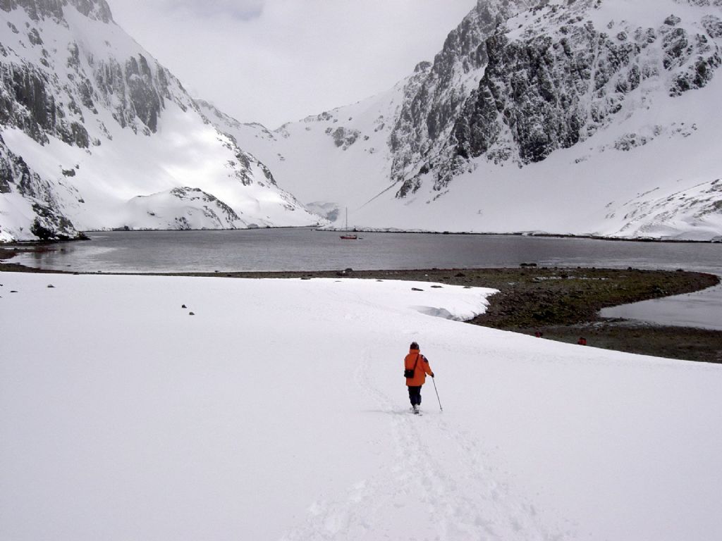
TREKKING: We follow the east coast of Cumberland Bay until Maiviken, a small settlement - the "Sarah" picks us up and we set sails to look for a good anchorage in one of the nearby creeks.
10. Day Maiviken - Larssen Fjord
We approach our first glacier as close as possible.
TREKKING: possibility to get some ice experience - we might find some safe ice caves, that would be tremendous: blue-white glossy and shining ice walls, silence.
11. Day Larssen Fjord - Ocean Harbour
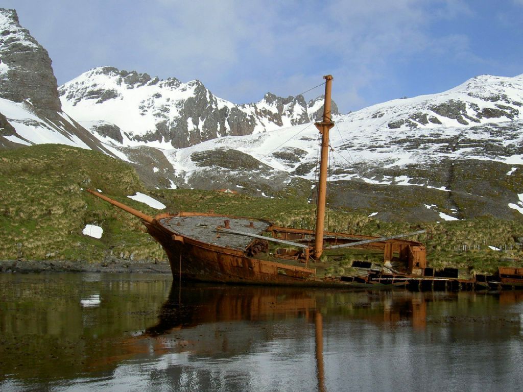
Well preserved ship wreck from the 19th century - sea elephant and fur seal colonies - walking inland we might view some reindeers and waterfalls - like the reindeer also rats had been introduced by man, rats now infest most of the northern shores of the island and are a severe danger for the indigenous plants and animals.
12. - 13. Day Ocean Harbour - St. Andrews Bay
TREKKING: we can hike along the coast towards St. Andrews Bay.
Breeding colony of approximately 100.000 king penguin close to the Heaney Glacier - king penguins are 1 meter tall and the most elegant of all penguins - the emperor penguin is taller but less elegant and breeds during winter, therefore he is very difficult to reach - the king penguin breeds on some subantarctic islands that get hardly reached by passenger ships, they do not breed on Antarctica itself - therefore this is a truly unique opportunity.
TREKKING: reaching the Nordenskjöld top (2.355m) would take 2-3 days severe mountaineering, including the crossing of some glacier fields.
14. Day St. Andrew Bay - Gold Harbour
Again we get a splendid opportunity to watch the king penguins - slowly we will continue towards Gold Harbour.
15. Day Gold Harbour - Cooper Bay
We have reached the most southern point of South Georgia (54°50 South, 35°45 West) - the coast is exposed to heavy storms and therefore consists of high cliffs and deep fjords.
16. Day Cooper Bay - Larsson Harbour
Larsson Harbour is a small fjord near the entrance to the enormous Drygalski Glacier - huge stone walls rise sky-high out of the southern ocean and produce a surrealistic atmosphere.
17. Day Drygalski Fjord
The most active and spectacular of all glaciers of South Georgia - the sea is covered by ice and ice bergs - the iceberg calving produces tremendous noise and reminds us of the immense natural force involved with this spectacle - blue-eyed cormorant colony.
18. Day Drygalski Fjord - Royal Bay
TREKKING: we observe the king penguin colony at Royal Bay and continue in westerly direction towards St. Andrews Bay - the path is rocky - we reach a plateau and have a magnificent view of the huge colonies of Royal Bay and St. Andrews Bay.
19. Day Royal Bay - Godthull
Remaining ruins from a whaling station - rusty factory units and whale bones remind us of the industrial past of this island.
20. Day Godthull - Cobbler's Cove
We anchor in a tiny but totally calm bay, though the entrance is difficult.
TREKKING: relatively easy we can reach a good height from where we can overlook the whole Cumberland Bay.
21. Day Cobbler's Cove - Leith Harbour - Stromness Bay - Husvik
We will see 3 whaling stations today - huge, industrial installations give us an indication about the enormous scale of these whaling factories.
22. Day Stromness Bay - Fortuna Bay - Hercules Bay
Biggest colony of macaroni penguins with approximately 80.000 animals.
23. Day Hercules Bay - Prince Olav Harbour - Bay of Isles - Albatross Island
At Prince Olav Harbour we visit for the last time a whaling station - at Bay of Isles we can watch huge numbers of fur seals and breeding Albatross - due to the high concentration of fur seals at Rosita Harbour it is impossible to make a landfall here - at Albatross Island we get perfect opportunities to watch breeding Albatross: Wandering, Sooty, Giant Petrel and Grey Headed Mollymauk.
24. Day Albatross Island - Elsehul
TREKKING: last opportunity for a long track to the most south-western part of the island - we can reach as far as Undine Harbour and Cape Paryadin - we watch the tumultuous Sea Strait between Bird Island and South Georgia, totally exposed to all seas and weathers - several breeding Albatross - this is a fulfilling moment and the right spot for our last day at South Georgia.
25. - 32. Day South-Georgia - Falklands
33. Day Port Stanley - Goose Green
After 30 days of near isolation we will enjoy the advantages of civilisation again - sail along the southern part of East Falkland Island - Goose Green was one of the important battle grounds - Argentinean war cemetery - Goose Green is one of the biggest farms of the Falklands.
34. Day Goose Green - Port Stanley
Sail back to Port Stanley and preparations for the departure.
35. Day Port Stanley - Mount Pleasant
Transport back to Mount Pleasant Airport.